
How Brooke County Property Records Fit Together
No single Brooke County record answers every property question. The Assessor Property Record Search is the right first stop. It accepts a street address, owner name, account number, or district. It also takes a map/parcel key, property type, legal description, or deed book and page. A result ties the tax-roll name to a parcel. Custody then splits by office. The County Clerk holds deed and lien instruments. The Sheriff Tax Office answers bill and payment questions. MapWV adds location and parcel geometry.
Match the sequence to the question. A house-history search starts at the parcel card. It then moves through deeds, directories, maps, and court or probate files. A purchase check compares the newest clerk deed with the assessor's CURRENT OWNER field. A boundary question begins with GIS but ends at a recorded plat or survey. Taxes need their own care. Keep the assessed value apart from the bill and its levy.
- Search the Brooke Assessor by Parcel Address, owner name, or map/parcel. Save the account and deed book/page.
- Use the County Clerk reference to find the recorded deed, then compare its grantor, grantee, and legal description.
- Check the Sheriff tax inquiry for the tax year and payment status tied to that parcel.
- Open MapWV to place the parcel and see nearby map features. Zoom in before reading its polygon.
- For a certified copy, an older book, or a record not online, contact the custodian that holds it.
Brooke County Offices Behind the Records
Custody drives everything in Brooke County property records. The Assessor values property and maintains parcel cards, and the County Clerk records deeds, mortgages, releases, liens, plats, and probate material. The Sheriff collects the taxes. The State Auditor enters the picture only after delinquent real-estate taxes are certified. Municipal offices hold zoning, permits, code, and development files. They do not replace county land records.
Brooke County Clerk
632 Main Street, Suite 201
Wellsburg, WV 26070
304-737-3661
Brooke County Assessor
200 Courthouse Square, second floor
Wellsburg, WV 26070
304-737-3667
Brooke County Sheriff Tax Office
202 Courthouse Square
Wellsburg, WV 26070
304-737-3663
Brooke Assessor Search Fields
The assessor's free search accepts several independent keys. A failed street query is never the end of a Brooke County property search. Owner Name goes LAST NAME FIRST NAME, no commas. Parcel Address is the physical location. Map and Parcel sit in separate boxes. Account number, District, Property Type, Legal Description, and Deed Book/Page can narrow a record when an address has changed or the tract is rural.
Each card displays CURRENT OWNER, MAILING ADDRESS, STREET ADDRESS, legal description, sales history, assessment record, and map/parcel. The deed book and page move you from the tax roll to a recorded instrument. A building record link requires login. Map-card and tax-data links give other views. The Brooke Assessor search form shows the live labels and the name-entry instruction on its official page. It works well as a quick reference for the county's available search fields.
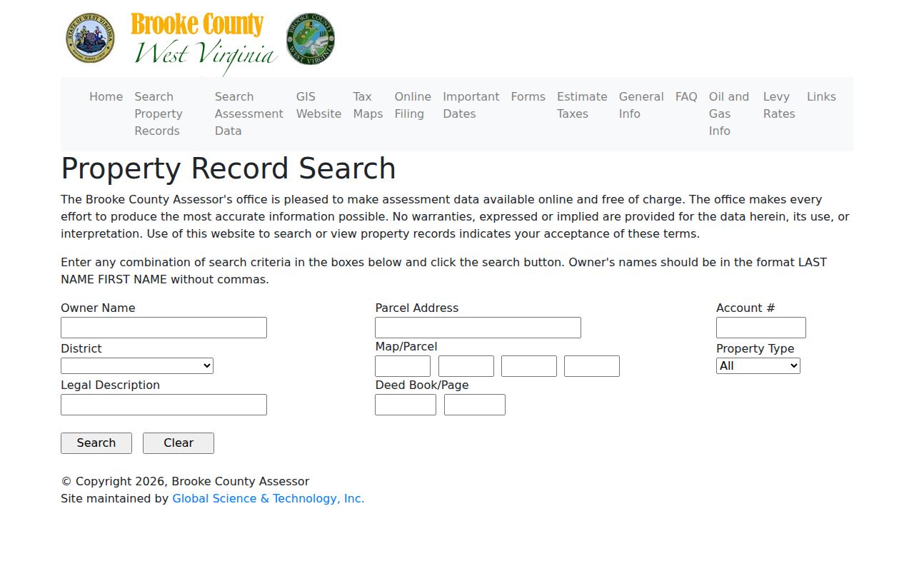
Once a search result appears, save the parcel key and the deed reference before moving on to the clerk or MapWV. Those two identifiers carry across offices and make the next lookup far easier.
| Assessor field | What it finds | When to use it |
|---|---|---|
| Owner Name | Tax-roll name, entered surname first | Find parcels tied to a person or entity |
| Parcel Address | Physical address | Start with a known property location |
| Account # / District | County tax identifiers | Refine a result from a bill or office note |
| Map/Parcel | Tax map components | Match assessment and GIS parcel keys |
| Legal / Deed Book-Page | Tract wording and recorded reference | Bridge an older deed to the present card |
Brooke County Values Follow July 1
The assessment date in Brooke County is July 1 each year. The assessor's guidance says market or appraised value multiplied by 0.60 generally yields assessed value. That is a tax formula, not an estimate of what a buyer will pay. The assessor determines the taxable value, while county, municipal, school-board, state, and special levies determine the tax charged.
The date also explains why records can appear to disagree. A deed may have been recorded after the assessment snapshot, but the July bill is based on property deeded in the taxpayer's name as of July 1 of the prior year. The clerk's newest deed is the evidence of a recorded transfer; the tax bill answers which cycle and amount the Sheriff lists. A value lookup should retain the assessment year beside the figure.
Tax class has a location component. Class II covers owner-occupied residential property and farms; Class III is other property outside a municipality; Class IV is other property inside one. The assessor lists Bethany, Beech Bottom, Follansbee, the Brooke part of Weirton, Wellsburg, and Windsor Heights as municipalities. A class is not a zoning label or proof of present occupancy.
Brooke Sheriff Tax Calendar
The Brooke County Sheriff Tax Office sits at 202 Courthouse Square in Wellsburg. Bills go out in mid-July. Mailing goes to the last known owner and address. Payment by September 1 earns a 2.5% discount, and September 30 is the base amount. Interest starts after October 1. It runs 0.75% per month, or 9% per year. The tax year runs July 1 through June 30.
Unpaid taxes turn delinquent on April 1. Publication fees are added May 1. The current Sheriff FAQ says SB 552 sends unpaid real-estate taxes to the State Auditor after close of business on October 31. That ended the old November courthouse tax-lien sale described in older material. The Auditor now handles redemption. The Sheriff advises allowing about two weeks after November 1 for processing.
The Sheriff's tax FAQ publishes the discount and interest dates. That official timing matters when an older tax-sale page shows up in search results.
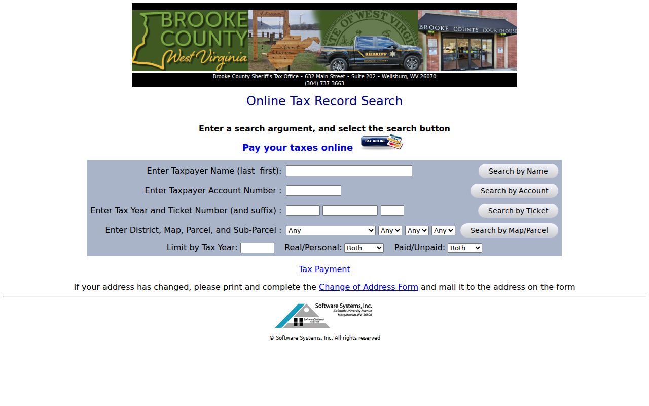
Keep the tax year and bill status together. Pair them with the certification date when checking a parcel against the current owner field.
MapWV Parcel Search in Brooke County
The WV Property Viewer pairs E-911 address matching with parcel attributes and map geometry. Its address search runs through the Statewide Addressing and Mapping System. It wants a street, city, and state abbreviation. Rural routes and PO boxes will not match. For parcel attributes, pick the county first. Then search by parcel number, owner, or property address. Geometry search works differently: draw an area on the map and pull everything inside it.
Results list a GIS ID, owner names, and address details. Open a parcel and the panel can show the physical address. It can also show building information, cost and appraised values, flood details, community, delinquent status, and a link to the assessment report. Copy Link, KMZ download, and CSV export are all supported. Results stop at 1,000. Narrow any broad owner or geometry search to keep the list workable.
One cartography caveat matters. MapWV draws parcel boundaries only once the map is zoomed to roughly 1:18,056 or closer. The help text labels those tax-map lines a best-fit visualization. Deeded acreage remains the official historic figure for conveyance and boundary records.
The map helps you locate a parcel record and its neighbors. It does not settle where a fence or surveyed line must sit.
Record Sets in Brooke County Property Files
Brooke County property files hold several distinct record sets. Deeds and other instruments transfer the land itself. The tax roll describes each assessed parcel. Bills and payment entries track what is owed. Court filings can affect a claim. Plat maps help you locate the tract on the ground. Every set has a different custodian and a different weight of authority. A parcel card may point you to a deed, but it does not replace one; a tax bill reveals status without proving title.
| Record Type | What It Documents | Kept By | Access |
|---|---|---|---|
| Deeds and plats | Transfer terms, legal descriptions, lot references | Brooke County Clerk | Document Inquiry and clerk counter; confirm copy fees |
| Mortgages, liens, releases | Recorded claims and later satisfaction or assignment | Brooke County Clerk | Search names, instrument type, or deed reference |
| Assessment card | Current owner field, parcel, values, sales history | Brooke Assessor | Free online search; building record link needs login |
| Tax bill | Tax year, payment, delinquency, certification | Sheriff Tax Office / State Auditor | Online inquiry; ask custodian about unlisted fees |
| GIS and tax maps | Parcel shape, address, map ID, nearby geography | MapWV and Brooke Assessor | Viewer/export; full-size assessor map may be purchased |
| Permits and zoning | Municipal land use, building work, code or development | City clerk or planning office | City-specific request; no countywide permit index verified |
Start a recorded transfer with the Brooke County deed records. For the amount owed, go to the tax office directly rather than inferring it from an assessed value. The property tax records page explains that calendar and how exemption and class fields fit into it.
Brooke County Deeds and Archive Years
The County Clerk publishes no stated cutoff for its online deed index or image access. Do not assume a web search reaches any particular year. The West Virginia Archives inventory tells a firmer story. It confirms Brooke deed indexes from 1797 through 1948. Deed books run from 1797 through 1901. The listing also covers trust deeds, surveys, homestead declarations, and judgment liens. It adds oil and gas leases, court books, and estate records.
To chain title backward, save the current deed book and page from the assessor first. Then retrieve the instrument through Document Inquiry or at the clerk counter. Note each grantor, grantee, legal description, and any earlier reference the document cites. When the online trail ends, ask the clerk what current index exists. Turn to the Archives listing to identify a microfilm series. A catalog entry is only a guide to the collection. It does not promise the images are online.
The West Virginia Archives Brooke County inventory lists the historic books and indexes. That page marks the county's archive block and the long deed-index span.
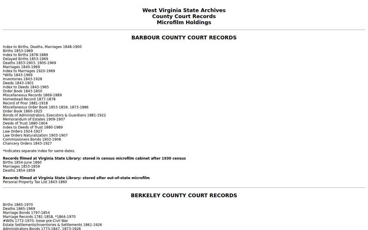
Older land work may reach beyond Brooke's borders. From 1777 to 1801, some early Brooke property appears in Ohio County records, so predecessor-county material can hold the missing link.
Brooke County Directories Bridge Old Addresses
Local directories and newspapers bridge an old name or street to a modern parcel. Wellsburg directories exist for 1908-1910 and 1910-1912, with later Wellsburg/Follansbee volumes from 1975, 1979, 1982, 1984, and 1989. Weirton directories span 1971-1999 with gaps. An 1871 Wellsburg map with entries offers an earlier street or occupant clue.
Directory entries may carry a name, spouse marker, occupation, and street address. Those details build a dated timeline to compare with deeds, census years, and newspaper notices. A directory names an occupant at an address; it does not establish land ownership. The Weekly Herald reels cover 1854-1865, and the Wellsburg Daily Herald reels cover 1899-1909, useful for probate notices, sheriff sales, street work, and property stories.
The former genealogy collection is now held by the Brooke County Historical Museum by appointment. Call ahead, save the volume and page citation, and ask whether scans or copies are permitted. The library's own history notes that service resumed after the 1936 flood and moved to the current location in 1972, one reason older material may be dispersed.
Brooke County Court and City Files
A property fight often leaves its trail in court before any deed records the outcome. Circuit and magistrate dockets in Brooke County can carry the dispute itself. The West Virginia Judiciary runs a statewide case search. It covers both civil and criminal matters. Online circuit records reach back to 1999. Each result shows the case number, the parties, the case type, the filing date, events, and the disposition. Not everything is there. Pleadings, exhibits, and certified copies may not be available online. For older files, ask the Brooke Circuit Clerk, who can also quote local charges for copies.
Search by more than a street address. Names and legal descriptions help. Foreclosure, partition, quiet-title, mechanic's-lien, and probate-sale cases may be indexed to a lender, a company, an executor, or a prior owner of record rather than the current owner. Read the complaint, the legal description, the judgment, the sale order, and any deed that followed the ruling. A docket entry alone transfers nothing.
City permits, zoning files, and code records often lack a public address index. In that case, send a focused request to the municipal clerk or the planning office. West Virginia FOIA, W. Va. Code §29B-1-1 et seq., points each request to the record custodian. It sets a response deadline of no more than five days, excluding weekends and legal holidays, subject to exemptions. The law does not require the office to build a new database.
Note: A docket event is a lead, not a deed. The recorder's deed records remain the proof of transfer.
When a Brooke County Search Misses
An empty result usually means a format mismatch, not a missing property. Try the owner name surname first, with no commas. Drop the apartment number. Shorten the street name or use the street-name field alone. When an address still will not resolve, search the tax district and the map and parcel number instead. Legal-description words such as subdivision, lot, tract, road, survey, or creek can also break the logjam.
A recent parcel split may lag in the statewide viewer. MapWV relies on counties to submit updates. Its FAQ suggests calling the local assessor. New lines may not have shown up after two years. Rural routes and PO boxes fail the viewer's E-911 address match. So switch to an owner, parcel, or geometry search there. If the online card shows no image, take its deed book and page to the clerk. Do not guess what the index holds.
Write down the failed key and every alternate key you tried. A street number, a postal city, a mailing address, and a municipal boundary are four different things in Brooke County. Treating them as one wastes time.
What Brooke County Property Records Cannot Prove
Public property records can prove a lot. They show an owner name, a recorded transfer, a taxable value, an unpaid tax bill, a parcel polygon, or a court event. They do not all refresh on the same schedule. The assessor card is not a title opinion, and GIS is not a boundary survey. Assessed value is not a sale promise. A sales-history line is not a full chain of title, so compare the date, the parcel number, and the custodian behind each result before trusting any single entry.
Lawful use. Use Brooke County property records for property research, purchase diligence, tax questions, and civic review. Do not use an address or owner field to stalk, threaten, or harass a person.